Topographic, Bathymetric & Underground Surveying
At MAS GMTL, we deliver precision-driven surveying solutions that cover land, marine, and underground conditions. Using the latest GNSS/GPS systems, LiDAR, UAVs, multibeam sonar, echo sounders, and Ground Penetrating Radar (GPR), we capture the critical data required for safe design, efficient construction, and risk-free operations.
List of Services:
- Topographic Surveying
- Bathymetric / Hydrographic Surveying
- Underground Utility & Subsurface Detection
- Integrated Survey Solutions

Topographic Surveying
- Land Elevation & Contour Mapping
- Topographic Mapping
- Boundary & Property Line Surveys
- Digital Terrain Modeling (DTM)
Bathymetric / Hydrographic Surveying
- Single & Multibeam Echo Sounding
- Side-Scan Sonar & Seabed Classification
- Tide & Current Measurements
- Volume & Dredging Computations
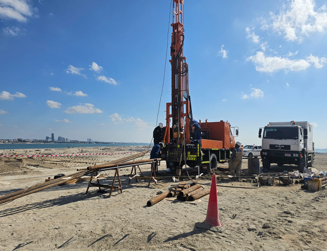
Underground Utility & Subsurface Detection
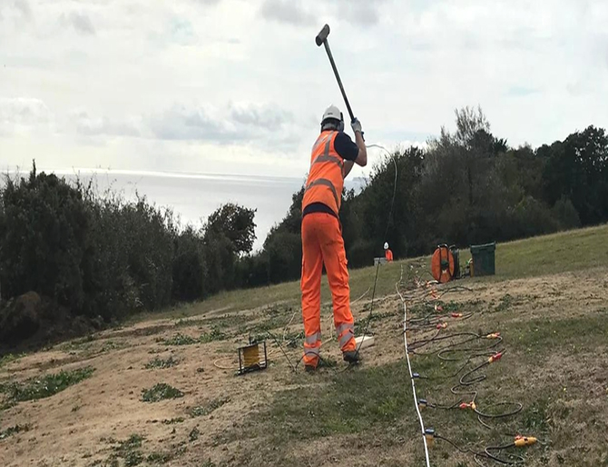
- Ground Penetrating Radar (GPR) Surveys
- Electromagnetic (EM) & Conductivity Surveys
- As-Built Utility Mapping
- Subsurface Obstacle & Void Detection
Integrated Survey Solutions
- Combined Land–Marine–Utility Packages
- GIS & CAD Deliverables
- Construction & Design Support
Topographic Surveying
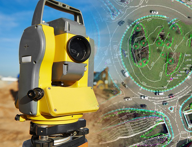
Land Elevation & Contour Mapping
We produce highly detailed contour maps and elevation models that capture subtle terrain variations. These maps are essential for planning foundations, drainage, grading, and road alignments. By modeling slope gradients and terrain breaks, we help engineers and designers minimize risks and optimize layouts.
Topographic Mapping
Our surveys document all natural and man-made features—trees, buildings, utilities, roadways, fences, and drainage patterns—providing a complete site overview. This data forms the backbone of master planning, infrastructure design, and construction layouts.
Boundary & Property Line Surveys
Using high-precision GNSS and total stations, we define property limits with legal accuracy. These surveys support land acquisition, zoning approvals, and dispute resolution, ensuring compliance with UAE land laws and municipal requirements.
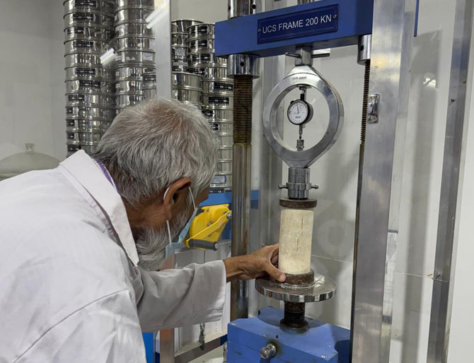
Digital Terrain Modeling (DTM)
By integrating survey data with advanced software, we generate 3D terrain models. These DTMs are used for volumetric analysis, cut-and-fill optimization, and design simulations, providing stakeholders with accurate visualization and measurable design data.
Bathymetric / Hydrographic Surveying
Single & Multibeam Echo Sounding
We deploy sonar systems to map seabed depths and underwater features with high accuracy. Single-beam sounding provides profiles along defined lines, while multibeam offers continuous 3D coverage of the seabed—critical for port works, dredging, marine structures, and reclamation projects.
Side-Scan Sonar & Seabed Classification
Side-scan sonar produces detailed images of the seabed surface, identifying hazards, wrecks, obstacles, and seabed textures. This data supports dredging operations, marine engineering, and environmental assessments by distinguishing between rock, sand, and silt.
Tide & Current Measurements
We conduct tide monitoring and current velocity surveys to understand hydrodynamic conditions. This information is vital for marine construction, coastal engineering, navigation safety, and sediment transport analysis.
Volume & Dredging Computations
Bathymetric data is processed to calculate material volumes for dredging, excavation, and reclamation. Our surveys help track progress, verify contractor works, and optimize dredging operations to ensure cost-effectiveness and compliance with project specifications.
Underground Utility & Subsurface Detection
Ground Penetrating Radar (GPR) Surveys
GPR is used to detect underground anomalies, including utilities, voids, and buried structures. This non-destructive technique provides real-time imaging, helping contractors avoid costly clashes with unknown subsurface conditions during excavation and foundation works.
Electromagnetic (EM) & Conductivity Surveys
EM detection complements GPR by identifying both metallic and non-metallic utilities at varying depths. These surveys help locate water, gas, sewer, and telecom lines, providing a complete subsurface utility map.
As-Built Utility Mapping
We prepare accurate “as-found” utility maps that integrate survey data into GIS and CAD systems. This ensures designers and contractors have a reliable record of existing utilities, preventing clashes and supporting future infrastructure upgrades.
Subsurface Obstacle & Void Detection
By combining GPR, EM, and conductivity tools, we identify underground obstructions such as boulders, cavities, or old foundations. Detecting these early reduces construction risks, improves safety, and avoids delays.
Integrated Survey Solutions
Combined Land–Marine–Utility Packages
We offer integrated survey solutions that combine topographic, bathymetric, and underground utility investigations in one mobilization. This reduces costs, eliminates duplication, and ensures all datasets are spatially consistent.
GIS & CAD Deliverables
Survey results are processed into GIS and CAD formats, providing engineers and planners with data that can be directly applied to design and construction workflows. Digital integration ensures efficient project execution and easy data sharing.
Construction & Design Support
Our survey teams work closely with engineers, contractors, and consultants throughout the project lifecycle. From pre-construction baseline surveys to as-built verification, we provide continuous support, ensuring projects meet design intent, authority requirements, and safety standards.