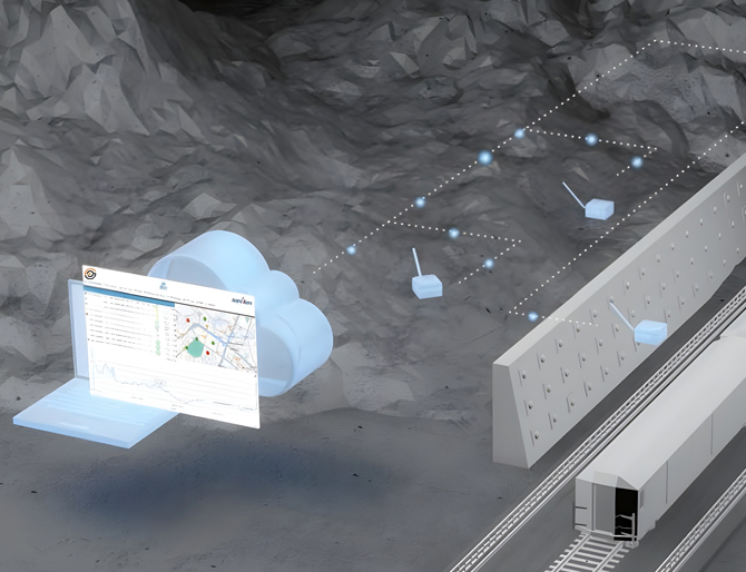
Geophysical Testing
At MAS GMTL, we provide advanced Geophysical Testing Services to evaluate subsurface conditions with accuracy, efficiency, and minimal disruption. Using cutting-edge techniques such as Multichannel Analysis of Surface Waves (MASW), Electrical Resistivity Tomography (ERT), Ground Penetrating Radar (GPR), Seismic Refraction and Reflection, Magnetic and Electromagnetic Surveys, and Borehole Geophysical Logging, we deliver comprehensive insights into soil properties, bedrock profiles, underground utilities, and potential anomalies.
These non-invasive methods complement traditional geotechnical investigations, helping engineers, developers, and planners reduce uncertainty, identify risks early, and optimize design solutions. By integrating geophysics with soil investigations, MAS GMTL ensures safer, more reliable, and cost-effective project outcomes.
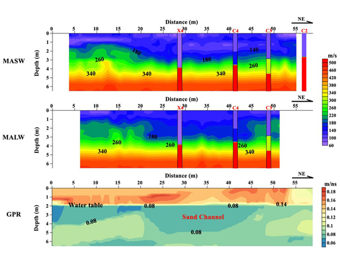
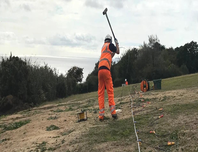
Multichannel Analysis of Surface Waves (MASW)
Methodology: MASW uses seismic surface waves to determine shear wave velocity profiles of subsurface layers.
Purpose: Evaluates soil stiffness, seismic site classification, and liquefaction potential.
Benefit: Provides critical data for earthquake engineering, foundation design, and identifying weak or compressible soil zones where drilling access may be limited.
Electrical Resistivity Tomography (ERT)
Methodology: ERT measures the ground’s electrical resistance to create 2D and 3D subsurface images.
Purpose: Identifies groundwater flow, contamination plumes, underground utilities, and soil stratigraphy.
Benefit: High-resolution imaging without extensive excavation, enabling environmental assessments and geotechnical design with greater confidence.
Ground Penetrating Radar (GPR)
Methodology: GPR transmits electromagnetic waves into the ground and records reflections from subsurface features.
Purpose: Detects utilities, voids, buried structures, and anomalies in soil, asphalt, or concrete.
Benefit: A rapid, real-time, non-destructive survey method ideal for pre-construction hazard identification and infrastructure evaluations.
Seismic Refraction and Reflection
Methodology: Seismic waves are generated and analyzed to interpret subsurface layering. Refraction determines depth to bedrock and layer velocity; reflection maps deeper geological structures.
Purpose: Evaluates bedrock depth, fracture zones, sedimentary layering, and seismic hazards.
Benefit: Essential for large-scale infrastructure, dam construction, and seismic risk assessments, providing accurate data on subsurface continuity and strength.
Magnetic and Electromagnetic Surveys
Methodology: Magnetic surveys detect variations in the Earth’s magnetic field caused by ferrous objects or anomalies, while electromagnetic surveys measure soil conductivity to locate voids, tunnels, or buried utilities.
Purpose: Identifies metallic and non-metallic objects, geological features, and subsurface irregularities.
Benefit: Quick, non-invasive, and ideal for large-area reconnaissance before excavation or development.
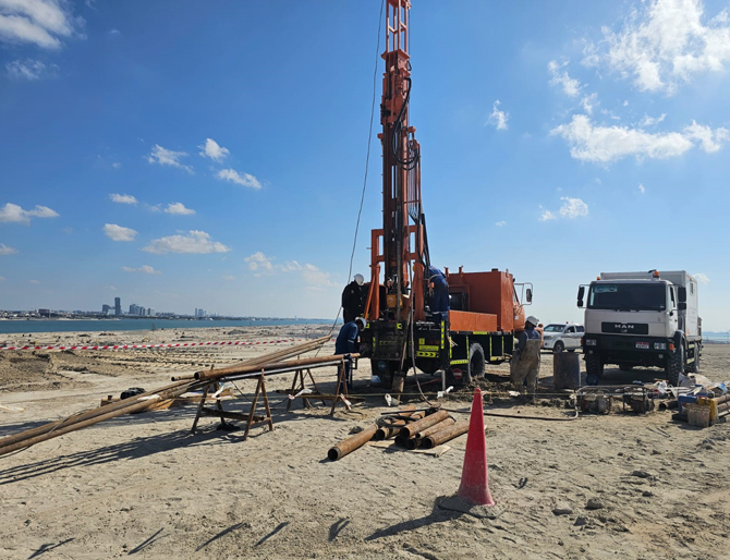
Borehole Geophysical Logging (Including Downhole, Crosshole & P-S Suspension Testing)
Methodology: Borehole geophysical logging involves lowering specialized instruments into drilled boreholes to record continuous profiles of the physical and mechanical properties of subsurface materials. MAS GMTL employs advanced techniques such as:
- Downhole Seismic Testing: A seismic source at the surface generates waves recorded by geophones at different borehole depths, producing shear-wave (Vs) and compressional-wave (Vp) velocity profiles.
- Crosshole Seismic Testing: Seismic waves are generated in one borehole and measured in adjacent boreholes at the same depth, giving highly precise velocity and stiffness data.
- P-S Suspension Logging: A probe with a seismic source and receivers is suspended in the borehole to continuously measure P-wave and S-wave velocities with depth.
Purpose:
- Determines dynamic soil properties for seismic site classification, liquefaction potential, and earthquake engineering.
- Identifies stratigraphy, weak zones, bedrock depth, and groundwater variations with high precision.
- Provides essential data for soil–structure interaction and deep foundation design.
Benefit:
- Downhole Testing: Reliable seismic velocity data for hazard assessments and dynamic soil analysis.
- Crosshole Testing: Highest-resolution measurements, ideal for critical projects requiring advanced soil–structure modeling.
- P-S Suspension Logging: Continuous velocity profiles, especially suited for deep dam foundations and large-scale infrastructure.
By combining borehole logging with geotechnical drilling and laboratory analysis, MAS GMTL ensures comprehensive, high-accuracy subsurface characterization that meets international engineering standards.
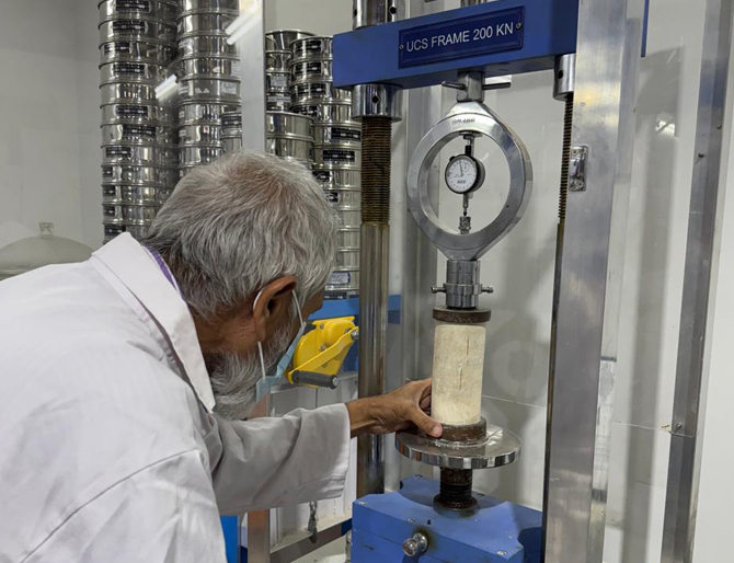
Geotechnical & Soil Investigation Support
Methodology: Integration of geophysical surveys with soil sampling, in-situ testing, and laboratory analysis.
Purpose: Provides comprehensive evaluation of soil density, strength, and composition.
Benefit: Offers a complete picture of site conditions, minimizing risk in foundation design and ensuring safe, cost-effective construction solutions.
Partner with MAS GMTL
With state-of-the-art technology and an experienced geotechnical team, MAS GMTL delivers geophysical testing that enhances site investigation, supports safe design, and ensures long-term structural performance. Whether for construction, environmental remediation, or infrastructure planning, our solutions give clients the clarity and confidence needed for project success.
Want to Know More? | Contact Us